Read Time 5 mins
05/06/2024
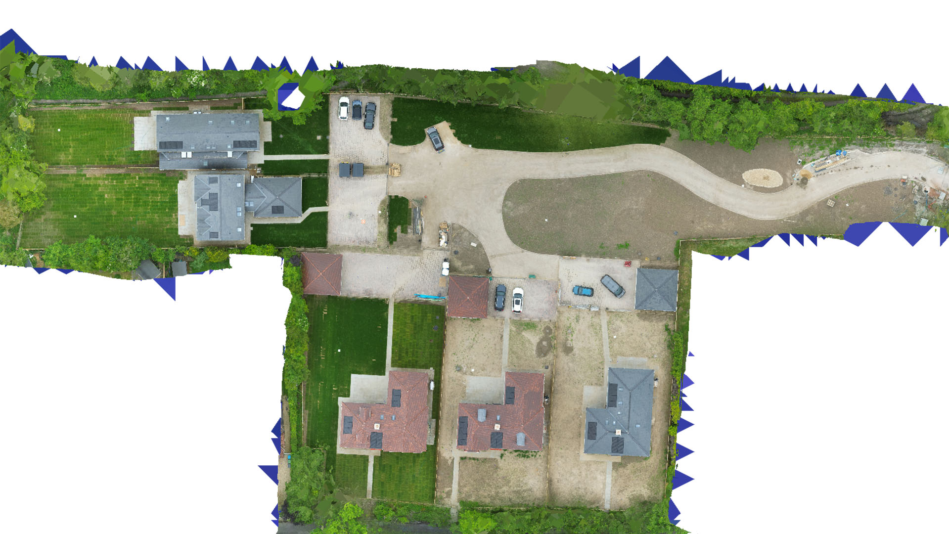
Drone Mapping and Surveying in Hoddesdon
Carrot Drone Services delivers state-of-the-art drone mapping and surveying tailored to support Hoddesdon's thriving industrial sector and local community projects.
Advanced Drone Solutions for Hoddesdon
In Hoddesdon, our drone services are fine-tuned to assist with the local industrial activities, urban development, and environmental conservation, providing essential data that supports sustainable and efficient project management.
Applications of Our Drone Services
Our targeted drone operations in Hoddesdon include:
- Industrial Facility Mapping: Detailed surveys for industrial sites to optimize layout and operations, ensuring safety and efficiency in facility management.
- Urban Redevelopment: Support urban redevelopment initiatives with accurate aerial data, helping to transform community spaces and improve local infrastructure.
- Environmental Monitoring: Conduct environmental studies and monitor green areas to assist in maintaining biodiversity and ecological health.
- Event Planning: Provide aerial surveillance and planning support for local events, enhancing security and operational logistics.
- Real Estate Development: Offer real estate developers precise topographical data and imagery that aid in the planning and marketing of new housing developments.
Why Choose Carrot Drone Services in Hoddesdon?
Carrot Drone Services is committed to delivering precision and innovation in drone technology for Hoddesdon. Our deep understanding of local needs and the regulatory landscape ensures that we provide services that not only meet but exceed client expectations.
Contact Us
To learn how our drone services can facilitate your projects in Hoddesdon, please contact us or call us at +44 3333 034874.