Read Time 5 mins
04/06/2024
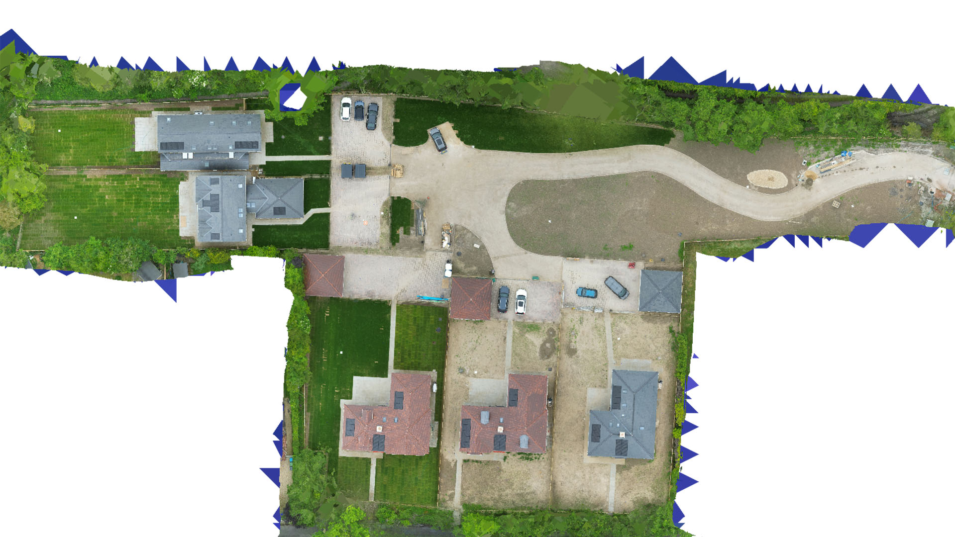
Drone Mapping and Surveying in Hertfordshire
Utilize cutting-edge drone technology for detailed and accurate topographical data across Hertfordshire.
Expert Topographical Mapping Solutions
Carrot Drone Services offers expert drone-based topographical mapping, vital for a range of applications in Hertfordshire. Our high-resolution aerial data aids in planning and development across various sectors, ensuring precision and reliability.
Applications of Our Mapping Services
Our drone mapping services provide essential data for numerous practical applications:
- Construction Planning: Support construction projects with accurate cut and fill calculations, helping to estimate the volume of soil to be added or removed.
- Real Estate Development: Detailed site surveys assist developers in making informed decisions about property potential and development constraints.
- Environmental Management: Map natural habitats and monitor environmental changes to support conservation efforts.
- Boundary Surveys: Define precise property boundaries for legal and commercial purposes, reducing disputes and simplifying transactions.
- Infrastructure Development: Aid in the design and maintenance of infrastructure by providing accurate maps of existing conditions.
Why Choose Carrot Drone Services?
Choosing Carrot Drone Services means partnering with a leader in drone technology. We are committed to delivering high-quality, actionable data that empowers our clients in Hertfordshire to execute their projects with greater accuracy and efficiency.
Contact Us
For more detailed information about how our drone mapping and surveying services can benefit your specific project in Hertfordshire, please contact us or call us at +44 3333 034874.