Read Time 5 mins
20/02/2025

Revolutionising Construction and Earthwork Surveys with Drone Technology in the UK
Introduction to Drone Technology in Construction
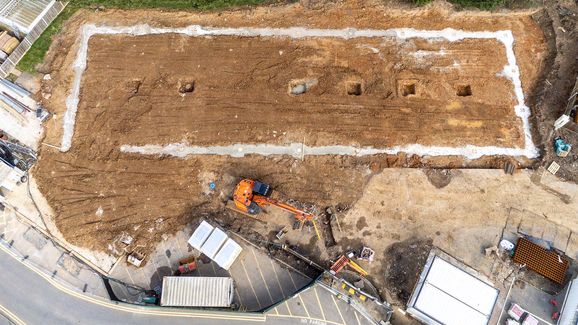
Drones are transforming how construction and earthwork surveys are carried out across the UK. By capturing high-resolution aerial data quickly and efficiently, they provide construction teams with accurate site information, helping to streamline planning and execution.
Traditional survey methods can be time-consuming and costly, often requiring extensive manpower and specialised equipment. Drones offer a faster, safer alternative, collecting detailed topographical data with minimal disruption to site activities. Their ability to cover large areas in a short time means project timelines can be significantly improved while maintaining accuracy.
At Carrot Drone Services, we leverage advanced drone technology to support construction professionals with high-quality aerial mapping and surveying solutions. Whether it’s monitoring earthworks, assessing site conditions, or ensuring compliance with project specifications, our drone services provide the insights needed to keep projects on track.
The Benefits of Using Drones for Earthwork Surveys
Drones have become an essential tool for earthwork surveys, improving accuracy, efficiency, and safety while reducing costs. Their ability to capture high-resolution data quickly makes them an invaluable asset in construction.
One of the main advantages of drone surveys is precision. Equipped with advanced imaging and LiDAR technology, drones collect detailed topographical data, generating high-resolution maps and 3D models. This allows project teams to assess site conditions with greater accuracy, leading to better decision-making and resource allocation.
Safety is another key benefit. Traditional survey methods often require personnel to navigate difficult or hazardous terrain. Drones eliminate this risk by conducting surveys remotely, reducing the need for manual site inspections in potentially dangerous environments.
Cost-effectiveness is also a major advantage. Drones streamline the data collection process, reducing the time and labour required for traditional surveys. This leads to lower operational costs without compromising on quality or detail.
Faster data acquisition means project timelines can be significantly improved. Drones can be deployed quickly, capturing and processing survey data in a fraction of the time required by conventional methods. This helps keep projects on schedule and reduces delays caused by incomplete or outdated site information.
Additionally, drones support sustainability efforts by providing a non-intrusive way to monitor environmental impact. Their aerial perspective enables efficient site monitoring while minimising disruption to the surrounding landscape, ensuring compliance with regulatory and environmental guidelines.
Understanding UK Regulations for Drone Operations
Drone operations in the UK are regulated to ensure safety and compliance with airspace rules. For construction projects, it’s important to work with a certified and experienced operator who understands these regulations.
The Civil Aviation Authority (CAA) oversees drone usage, with specific guidelines on where and how drones can be flown. Operators must follow rules regarding flight permissions, altitude limits, and proximity to people and infrastructure.
Commercial drone operations, such as those used in construction, often require additional approvals and risk assessments. These ensure that flights are conducted safely and in accordance with legal requirements.
At Carrot Drone Services, we handle all regulatory considerations, ensuring full compliance so our clients can focus on their projects with confidence.
Professional Drone Services by Carrot Drone Services
Carrot Drone Services provides specialist aerial surveying and inspection solutions for the construction industry. Our advanced drone technology delivers accurate data quickly, helping projects stay on track and within budget.
We offer high-resolution aerial mapping, giving construction teams the topographical insights needed for effective planning and design. By capturing detailed imagery and generating 3D models, our drone surveys support informed decision-making throughout a project’s lifecycle.
Our drone inspections provide a safe and efficient way to assess structures and monitor site progress. Hard-to-reach areas can be surveyed without disruption, reducing the need for scaffolding or manual inspections while improving safety and efficiency.
We also offer regular progress monitoring, delivering real-time updates that support project management and stakeholder communication. With scheduled drone flights, teams can track development stages, identify potential issues early, and maintain oversight with up-to-date visuals.
Every project is different, and we tailor our services to meet specific requirements. Whether you need detailed site data, structural assessments, or ongoing monitoring, we ensure you get the right drone solutions for your needs.
To discuss how our services can benefit your project, please get in touch. Our team is ready to assist with your aerial surveying and inspection requirements.
Conclusion
Drones are changing the way construction projects are planned and managed. By providing accurate data quickly and efficiently, they help improve decision-making, reduce costs, and enhance site safety.
At Carrot Drone Services, we specialise in delivering high-quality aerial surveys, inspections, and progress monitoring tailored to the needs of the construction industry. Our expertise ensures that projects run smoothly while remaining compliant with UK regulations.
If you're looking for a reliable drone partner to support your construction or earthwork projects, get in touch. We’re ready to provide the insights and solutions needed to keep your project on track.
Contact Us
To learn more about our services or to get a quote, please complete our online form or call us at +44 3333 034874.