Read Time 5 mins
04/06/2024
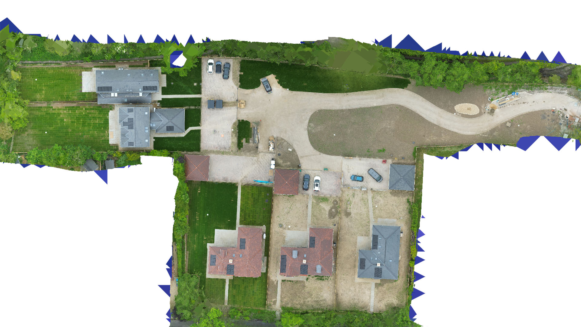
Drone Mapping and Surveying in Buckinghamshire
Deliver topographical accuracy and critical data with cutting-edge drone technology.
Specialised Drone Services in Buckinghamshire
Carrot Drone Services harnesses advanced drone technology to provide detailed and accurate mapping services across Buckinghamshire. Our services cater to various sectors, ensuring precise and actionable insights for every project.
Key Applications of Our Drone Services
Drone surveys in Buckinghamshire are essential for:
- Construction Development: Use detailed aerial data for site analysis, cut and fill estimations, and ongoing project monitoring to enhance project management and efficiency.
- Real Estate Analysis: Gain comprehensive aerial views for property assessments, promotional material, and planning developments to increase property value and attract investment.
- Environmental Conservation: Monitor and manage natural resources with high-resolution mapping, crucial for maintaining biodiversity and planning eco-friendly initiatives.
- Boundary Mapping: Obtain clear, undisputed boundary lines for real estate transactions, land disputes, and legal documentation, improving clarity and reducing conflicts.
- Infrastructure Projects: Support infrastructure development with accurate surveys that help plan roads, bridges, and utilities, facilitating smoother project execution.
Why Choose Us?
Choosing Carrot Drone Services means selecting a leader in precision aerial surveying. Our commitment to quality and attention to detail ensures that your projects in Buckinghamshire will benefit from the highest standards of data accuracy and service excellence.
Contact Carrot Drone Services
To find out more about how our drone mapping services can assist your specific needs in Buckinghamshire, please contact us or call us at +44 3333 034874.