Read Time 5 mins
04/06/2024
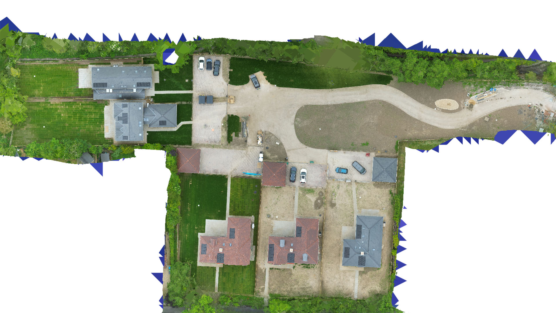
Drone Mapping and Surveying in Bedfordshire
Advanced drone technology for accurate topographical and survey data across Bedfordshire.
Comprehensive Mapping Services
At Carrot Drone Services, we provide detailed and precise topographical mapping essential for a variety of applications in Bedfordshire's diverse landscapes, from urban expansions to rural estates.
Applications of Our Topographical Mapping
Our drone services offer critical insights and data for several key applications:
- Construction Management: Essential data for site planning and management, including volume estimations for cut and fill operations, helping to streamline costs and improve efficiency.
- Real Estate and Land Development: Detailed surveys that provide developers with the necessary information to assess land potential and plan infrastructural developments effectively.
- Environmental Monitoring: Accurate environmental surveys to assist with conservation efforts, habitat assessment, and compliance with environmental regulations.
- Boundary Surveys: Precise mapping to define property lines and help resolve disputes or for planning purposes in legal and real estate transactions.
- Public Infrastructure Projects: Data to support the design and maintenance of public infrastructure, enhancing planning accuracy and operational efficiency.
Why Carrot Drone Services?
Our commitment to delivering high-quality, actionable insights makes us a preferred partner for businesses and government entities across Bedfordshire. Trust us to provide the data you need for successful project outcomes.
Get in Touch
Interested in our services? For a tailored solution to meet your specific needs in Bedfordshire, please contact us or call us at +44 3333 034874.